Fichier:Belgiewvl.png
Pas de plus haute résolution disponible.
Belgiewvl.png (398 × 335 pixels, taille du fichier : 3 Kio, type MIME : image/png)
| Ce fichier et sa description proviennent de Wikimedia Commons. | Accéder au fichier sur Commons |
Description
| Description |
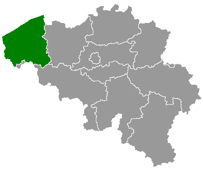
English: Map of Belgium with the 3 regions togheter , with the province of West Flanders colored green. |
| Date | |
| Source | Wikimedia Commons (Article 'Maps_of_Belgium') |
| Auteur | User 'Morwen' |
Conditions d’utilisation

|
Vous avez la permission de copier, distribuer et modifier ce document selon les termes de la GNU Free Documentation License version 1.2 ou toute version ultérieure publiée par la Free Software Foundation, sans sections inaltérables, sans texte de première page de couverture et sans texte de dernière page de couverture. Un exemplaire de la licence est inclus dans la section intitulée GNU Free Documentation License. |
| Ce fichier est disponible selon les termes de la licence Creative Commons Attribution – Partage dans les Mêmes Conditions 3.0 (non transposée). | ||
| ||
| Ce bandeau de licence a été ajouté à ce fichier dans le cadre de la procédure de mise à jour des licences des images sous GFDL. |

|
Une version vectorielle de cette image existe, dans le format « SVG ». Si elle n’est pas inférieure, elle devrait être utilisée à la place de la présente version pour des affichages en plus grandes dimensions ou nécessitant une meilleure résolution.
File:Belgiewvl.png → File:Province of West Flanders (Belgium) location.svg
Pour plus d’informations sur les images vectorielles, consultez la page de transition de Commons vers le format SVG. Voir aussi les informations à propos de la manière dont le logiciel MediaWiki gère les images au format SVG. |
_location.svg) |
Historique du fichier
Cliquer sur une date et heure pour voir le fichier tel qu'il était à ce moment-là.
| Date et heure | Vignette | Dimensions | Utilisateur | Commentaire | |
|---|---|---|---|---|---|
| actuel | 25 mai 2010 à 20:59 | | 398 × 335 (3 Kio) | DasRakel | filesize |
| 25 mai 2010 à 20:56 |  | 398 × 335 (61 Kio) | DasRakel | bxl shade | |
| 24 mai 2006 à 18:53 |  | 398 × 335 (6 Kio) | Btrs | {{Information| |Description= Map of Belgium with the 3 regions togheter , with the province of West Flanders colored green. |Source=Wikimedia Commons (Article 'Maps_of_Belgium') |Date=24 May 2006 |Author=User 'Morwen' |Permission=none needed , seen the GN |
Utilisation du fichier
La page suivante utilise ce fichier :
Usage global du fichier
Les autres wikis suivants utilisent ce fichier :
- Utilisation sur ar.wikipedia.org
- Utilisation sur bg.wikipedia.org
- Брюге
- Западна Фландрия
- Даме
- Кортрейк
- Остенде
- Шаблон:Западна Фландрия
- Бернем
- Бланкенберге
- Зеделгем
- Зойенкерке
- Кноке-Хайст
- Осткамп
- Торхаут
- Ябеке
- Алверингем
- Вьорне
- Де Пане
- Коксейде
- Нюпорт (Белгия)
- Диксмойде
- Кортемарк
- Кукеларе
- Ло-Ренинге
- Хаутхьолст
- Вервик
- Влетерен
- Зонебеке
- Ипер
- Лангемарк-Пулкапеле
- Месен
- Поперинге
- Хьовеланд
- Авелгем
- Анзегем
- Варегем
- Вевелгем
- Дерлейк
Voir davantage sur l’utilisation globale de ce fichier.