Fichier:James Cook NF Belle Isle.jpg
Taille de cet aperçu : 800 × 436 pixels. Autres résolutions : 320 × 174 pixels | 640 × 349 pixels | 1 024 × 558 pixels | 1 766 × 962 pixels.
Fichier d’origine (1 766 × 962 pixels, taille du fichier : 312 Kio, type MIME : image/jpeg)
| Ce fichier et sa description proviennent de Wikimedia Commons. | Accéder au fichier sur Commons |
Description
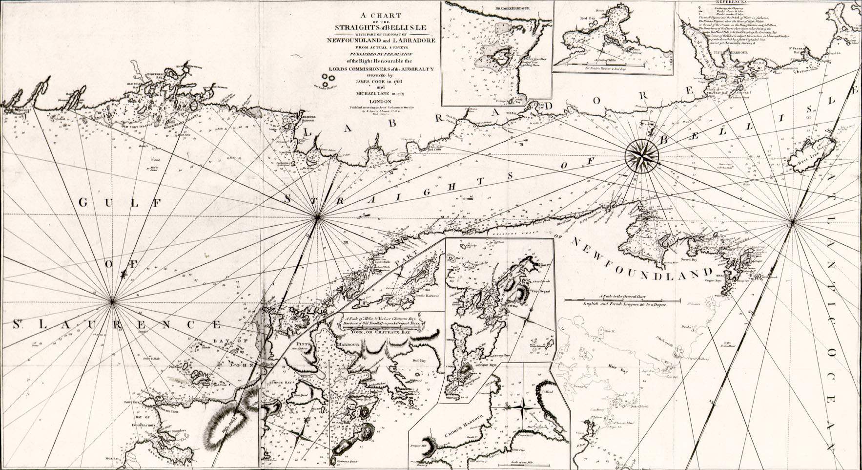
| Description | A chart of the straits of Belle Isle, including parts of the Newfoundland and Labrador coasts. Surveyed by James Cook in 1766 and Michael Lane in 1769. Printed by T. Jeffreys of London in 1770. |
| Date | |
| Source | http://www.heritage.nf.ca/exploration/chbelle_isle_500.html Courtesy of the Centre for Newfoundland Studies, Queen Elizabeth II Library, Memorial University of Newfoundland, St. John's, Newfoundland |
| Auteur | James Cook and Michael Lane |
| Autorisation (Réutilisation de ce fichier) |
Public domain because of age |
Conditions d’utilisation
|
Cette œuvre est également dans le domaine public dans tous les pays pour lesquels le droit d’auteur a une durée de vie de 100 ans ou moins après la mort de l’auteur. | |
| Ce fichier a été identifié comme étant exempt de restrictions connues liées au droit d’auteur, y compris tous les droits connexes et voisins. | |
Historique du fichier
Cliquer sur une date et heure pour voir le fichier tel qu'il était à ce moment-là.
| Date et heure | Vignette | Dimensions | Utilisateur | Commentaire | |
|---|---|---|---|---|---|
| actuel | 1 février 2008 à 11:26 | | 1 766 × 962 (312 Kio) | Shipguy | == Summary == {{Information |Description=A chart of the straits of Belle Isle, including parts of the Newfoundland and Labrador coasts. Surveyed by James Cook in 1766 and Michael Lane in 1769. Printed by T. Jeffreys of London in 1770. |Source=http://www.h |
Utilisation du fichier
La page suivante utilise ce fichier :